
The OzTrack team are proud to announce that 14 new environmental layers have been incorporated into the OzTrack website. These layers may be queried from within OzTrack to provide spatial and temporal information on habitat preference and reserve design.
Along with Bathymetry and Elevation data obtained from General Bathymetric Chart of the Oceans (GEBCO), a map of Australian Natural Resource Management (NRM) Regional Boundaries is provided as well as a map of fire frequency using data from the NOAA Satellite Information System.

Your animal tracks may now be overlayed on maps of terrestrial and marine protected areas from CAPAD 2010 and Australia’s network of Commonwealth Marine Reserves. This may allow wildlife managers to investigate whether the current design of these areas is sufficient to protect their study species.

We have incorporated land-use data from Australia’s Dynamic Land Cover dataset which reflect the structural character of vegetation. These range from cultivated and managed land covers (crops and pastures) to natural land covers such as closed forest and open grasslands.

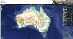
With the National Vegetation Information System (NVIS) Groups and Subgroup layers, we provide the latest summary information (November 2012) on Australia’s present native vegetation. The input vegetation data were provided from over 100 individual projects representing the majority of Australia’s regional vegetation mapping over the last 50 years. Data were obtained from the Environmental Resources Information Network (ERIN), Department of Sustainability Environment Water Population and Communities.
Finally the IBRA (Interim Biogeographic Regionalisation for Australia) regions and subregion layers, and the IMCRA (Integrated Marine and Coastal Regionalisation of Australia) provincial and mesoscale layers may also be visualised. These represent spatial units that contain broad patterns in biodiversity in the terrestrial and marine environment.
It is our hope to add more environmental layers to OzTrack in the coming months.
[contact-form]
Filed under: Uncategorized Tagged: analysis tools, animal tracking, Environmental layers, OzTrack, Ross Dwyer, telemetry